Upper Stikine Journal (Click here for Lower Stikine Journal)
(Campsite locations are given in UTM coordinates (NAD27). Distances are from the campsite to the Hwy 37 bridge.
22 July 2004: After we spent the morning packing & re-packing & nesting the canoes, Doug of Harbour Air flew us out from Tatogga Lake around 2 pm. We were his first flight to Happy Lake that year; a few weeks later he would fly in a group who would stay at Happy. We passed great scenery en route. Doug (keen eyes) pointed out goats on one of the mountain tops and also the red cliffs from which the Spatsizi gets part of its name; he said it’s unclear that the explanation for the name holds much water. The Klappan looked like a mud slide and indeed it is siltier than the Stikine. We landed, unloaded, said goodbye to Doug and set up camp on the west shore (at the narrows north of the island, close to the exit). There’s another site farther south, also on the west shore. What a magnificent place!
It’s clear why some people just stay there. Right away, we decided to stay three nights. After about an hour spent reassembling the Yukon, we swam, loafed and enjoyed the scenery.
Night 1: UTM 515 450. 274 km
Happy Lake – Morning Mist pic
23 July: We paddled over to the east side and tried to hike up but found the brush too thick. There’s a good view though of a waterfalls on the west side. We paddled to the downstream end, looked at the exit rapid and returned to camp; the others went fishing at the southwest corner of the lake (had moderate success) while I puttered around camp.
Night 2; same place.
24 July: We paddled a little south and then climbed through brush and forest on the west side, using a route spotted by Marilyn the previous day. We got to open ground and then a snow patch. Marilyn and I climbed the ridge between the larger “craters”; the net climb of 1950 ft left us still well short of the top. Views were great downstream (to an esker-like area between Happy and Tuaton Lakes, Tuaton Lake and surroundings), upstream (snow-covered mountains, streams and meadows) and across; it’s an utterly heavenly place. From the top we picked out a return route much easier than the one we used coming up. Once back down, we paddled over to the stream at the south-west end; the others fished some more, getting skunked.
Hike at Happy L pic
Night 3; same place.
25 July: The sky was mostly cloudy with rain patches visible all day. We packed up and started downstream. Marilyn and Robert tried to run the Yukondown the left side of the exit rapid but got hung up on the rock; Allan and Glenn lined the Nova Craft easily down the right channel. We portaged (river right) around the pair of falls before Tuaton Lake; there’s a small campsite (one tent) at the start. We disagree on the length of the portage; some said over 1 km, I guessed 700 m, and Hays gives 500 m. Whatever, the carry to the beaver pond is through high, almost continuous alder thickets; we were certainly the first group through that year. Glenn (ever the scout) went ahead and found a path turning left at the pond and going down a creek to the river; he found also a path leading off to the right, likely a low-water path. We waded down the creek, stumbling through alders that reached well over our heads. If you are averse to wet feet, don’t go down the creek; in fact, maybe you should start at Tuaton.
The portage is much better though than we expected from reading Voss. Those who follow her advice to start at Tuaton will miss the glory of Happy, unless they do as the Hays party and paddle up to Happy; it looks like pretty tough upstream work to me, but Hays did it in only two hours (with though only enough gear for a few days).
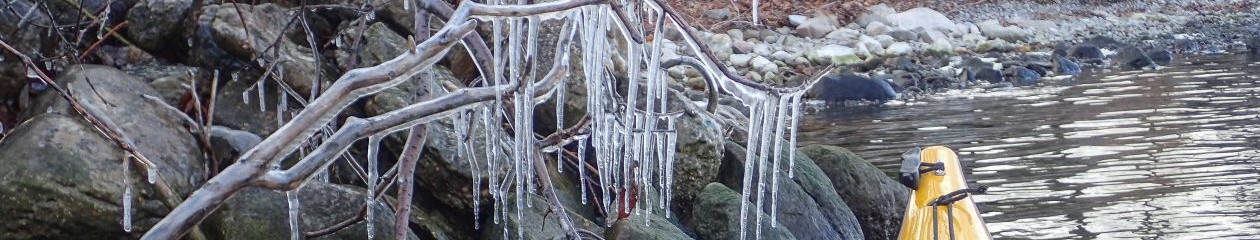
portage thru alder thicket pic
We loaded up, headed out and were soon joined by the Stikine, not much of a river at that point; we saw a caribou with a magnificent rack. We enteredTuaton Lake and lunched at a point on the right side, getting a bit wet from a rain squall. We paddled a nameless lake, entered Laslui Lake, passed a signedcampsite on the right, said hello to the staff at Laslui Lake Lodge and continued down Laslui. After a discussion, we decided not to push on to the campsite at the lower end of the Fountain portage; instead we camped by some trees at a point on the right about five km past the lodge, on lake bottom pushed up by the ice. Night 4; 672 573. 252 km
pic of Fountain rapids
26 July: We finished Laslui Lake, ran the marked CI (Lau recommends running it on river right) and portaged river right around Fountain Rapids. The portage starts at a bend to the left; it is signed, about 1 km long, in excellent condition and has a canoe rest about halfway. We lunched at the campsite at the end; there’s a smaller site about 100 m before the end. Robert fished but no luck again. Soon after starting out, we caught up to a caribou walking in the river close to the left shore; the current was pushing us on at about its pace. Trying not to stress it, we didn’t try to pass it but rather moved right, figuring it wanted to get out on the left. It carried on, so we moved to the left so it could cross; that didn’t work either. So then we just backed off. It soon crossed to the right shore; we expected it to vanish into the bush but it moved downstream on the shore. We passed it and paddled on, wondering why it had behaved so strangely.
After running a long series of rapids, we turned left into a surprise CII just before the portage sign (river left) for the Chapea Rapids; other sources saythe rapids start 3 km below Chapea Creek. We should have scouted the CII I guess (I was the weakest ww paddler of the group); whatever, we ran the upperpart and hastily eddied out on river left to scout the rest. There was another canoe group at the sign; they had pulled out on river left upstream from the sign, to avoid the CII I guess.
After taking the packs over the portage (about 1 km long, seriously wet in places, with a canoe rest about 2/3 along) and scouting the rapids on the way back, we ran the empty boats through CII ledges to the place where the trail comes near the river.
Robert and Glenn carried them from there, somehow. The trail is fairly rough; I hit the ground several times just carrying packs. The other group (10 people mostly from
Victoria, guided by Northern Sun Tours in Smithers) had started at Tuaton the day before and camped at the lower end of the Fountain portage; they had seen the caribou and also a wolf following it (which may have had something to do with its behaviour). They planned to camp at the end of the Chapea portage, where the Johnson-Meier party camped in 1973 (to me the site didn’t look big enough for 10 people). We passed them and continued downstream, looking for sites in Voss’s book; we saw one
(only) but it was too small. Glenn the scout spotted a grassy area on river left and we pulled in; though the area was marked as a marsh on the topo, the site was dry and not buggy so we set up. Robert fished downstream, getting skunked again.
Night 5; 853 615. 230 km.
pic of Glenn at bottom of Chapea Rapids
27 July: We ran more fun rapids and stopped for lunch at Chili Creek (where there’s a campsite); Robert got lucky (Dolly Varden and two grayling).Planning to hike to the falls, and feeling even lazier than usual, we stopped across from the mouth of Adoogacho Creek and made camp at a large site in the woods. Robert and Glenn ferried over, fished & were this time successful.
Night 6; 809 788. 211 km
pic of Steep Climb at Adoogacho Falls
28 July: We ferried across the river and hiked up the south side of the creek toward Adoogacho Falls. The climb to the top is not for the acrophobic; I stopped first, figuring that I would have trouble getting myself down even from where I was. The others continued but none of us saw the falls fully. There must be a better way to get to the top and indeed Hays had found one (it’s not clear from his report which side he went up). We lost contact with Marilyn, but met her back at the boats.
We had loafed the day before so we knocked off some distance on a less interesting part of the river. We worked through some large log jams (could be dangerous) above the Chukachida junction. After the left turn, we ran into a stiff west wind, but the current more than compensated for it. We passed the Northern Sun Tours group camped at what looked like a glorious site at the mouth of Sanabar Creek (river left). We camped well downstream, at the top end of the lower of two islands (the topo shows only one); the site was sandy but otherwise OK.
Night 7; 628 958. 161 km.
29 July: We passed the Spatsizi junction (the river thereafter was silty as promised), stopped at Upper Stikine Lodge 3 km downstream on river right and
talked to two young women there; they had horsebacked in from Tatogga Lake and were waiting for the wind to die down so they could get picked up and flown to Fish Lake (?). The lodge was not operating its B&B service that year; hope they start up again.
Jewel Rapids start near 452 119; it is long and difficult to scout from shore. There is no marked portage. Wainwright says that it can be portaged on eitherside; we weren’t looking for portage/scouting landings and not surprisingly didn’t see any. I saw no warning sign (Voss and Hays report one on riverright), but I did see a cross on river left. The start is easy to recognize from the big boulders in midstream. The rapids is unique in my experience. It is a collection of big boulders, most of the same size, scattered like salt grains spilled on a table. You have to watch out for more downstream as you dodge the ones right in front.The woman at Red Goat Lodge said that a couple dumped and lost one of their rental boats here; it got all the way through the canyon, not in one piece though.
The Northern Sun Tours guide had said that they would eddy-hop on the right. Lau says keep to the right at the first big rock, then go left of the big centre rock. Wright says start on the left and ferry right. The Bassett party dumped a boat here and the Adams party dumped one a km downstream; I don’t know how they would have fared if the other boat(s) hadn’t been there to rescue them. We ran the middle; the Yukon got through pretty cleanly but the Nova Craft shipped a fair amount of water.
We pulled in near the end of Jewel and camped at a huge site in the trees on river right, on the upstream side of the unnamed creek (nice clear water); the
other group passed us there. The text of Voss’s book correctly identifies the site as being on the upstream side; we saw no campsite at the downstream side,where Voss’s map 13 (page 138) places it. We set up our first major totem here, dressing a piece of driftwood with grass for a hair-do; it is now in Marilyn’s garden in Picton.
Night 8; 432 127. 128 km.
30 July: We passed the Pitman junction (clear water) and stopped at Schreiber Canyon (nice scenery) for lunch. We camped at an OK site on the north side
and near the lower end of the island past Kehlechoa River (didn’t see the mouth).
Night 9; 098 225. 83 km.
2 pics – Schreiber Canyon – conglomerate Stone
31 July: Another lazy day with nice but nothing special scenery. We stopped at a cabin on river right below Mount Sister Mary. Shortly afterward we camped at a great site on river left, across from the McBride River; we lazed around and did some hiking.
Night 10; 840 244. 51 km
pic of Bottom of Beggarly Canyon
1 August: We paddled over to the McBride, filled the jug with clear water and continued uneventfully to Beggerlay Canyon; the take-out on river right is signed big-time. Except for the steep rocky start, the portage trail (about 1 km long) around the canyon is in good condition;
the suspension bridge is a marvel (our thanks to whoever built it). Past the bridge, there’s a side trail to the mouth of the creek and nice clear water. The main trail ends at the campsite at the end of the big stuff but still in the canyon; Glenn the scout found a very steep, little used trail going tothe very end of the canyon. We carried the packs to the campsite and set up there; it’s sandyand small but otherwise fine. The Adams party (item I(e)12, nine people) camped here; it must have been rather crowded. The Northern Sun Tours group camped in the grassy area upstream from the creek. The canyon deserves some film. Glenn and I ran the canyon empty, going left below
the rock on the left and powering through the boils; Robert portaged the Yukon. One Adams boat dumped.
Night 11; 631 215 (approximate). 24 km to Hwy 37.
2 August: We left at 8 am and pulled in on river right below the Hwy 37 bridge shortly before 10 am; it would be difficult to miss the signs. The S turn
wasn’t as difficult as Jewel. As we were getting the gear out of the boats, a Texas-Idaho couple camped below the bridge came over and invited us to their
trailer for hot drinks and fresh peach pie, an offer we couldn’t refuse. They asked lots of questions about the trip; they had seen a cougar crossing Hwy 37
the night before. After an hour of socializing we loaded the truck and left for Dease Lake. We bought groceries and booze at the general store, drove to the
airport, picked up Erwin (who flew in with Northern Thunderbird Air) http://www.ntair.ca from Smithers) and squeezed him into the truck. We were late, his flight was early and the airport was about to close, leaving him stranded.
pic of Canyon Warning Signs
pic of Grand Canyon of the Stikine
We returned to Dease Lake, had lunch, shopped some more and started for Telegraph Creek (I didn’t see a sign
for it at Hwy 37; take the road to the airport and carry on). The first 2/3 of the road is pretty boring but the last part is great and we made several stops, including one at the village of Tahltan. The road is not for the weak in heart; some stretches are very close to edge of vertical drops. As we entered Telegraph Creek, we passed the airstrip where Marilyn and family had innocently camped in the dark several years before.
We ate supper at Stikine River Song and stayed there that night (highly recommended for both). The evening was spent repacking for the lower and
watching Stikine videos; fortunately the RiverSong has a huge common room. Eight canoeists from Victoria were also in Telegraph Creek, preparing for the lowerStikine; two stayed at the RiverSong and the others camped nearby. Next morning, Glenn dropped us off at the put-in and then drove to Stewart and Hyder to see the glaciers and the bears. He drove to Prince Rupert the next day, parked the truck at our B&B, stayed at another and flew back on the 5th.
Night 12; Stikine River Song at Telegraph Creek