Lower Stikine Journal (Click here for journal for Upper Stikine)
Campsite locations in Canada are given in UTM coordinates (NAD27). Longitude and latitude are used for sites in the US. Distances are to the harbour in Wrangell. Where appropriate, I give two values. The first includes the side trip down the North Arm to the edge of the Le Conte Glacier (where it was when the topo was printed; I was told later that it has since receded 2 miles) and then to Wrangell through Strait. The second value, 71 km shorter, is the direct distance as measured down the main channel, without the side trip. The distance from Telegraph Creek to Wrangell is 318 km via Le Conte Bay, 247 km by the direct route.
Night 12; Telegraph Creek. 318 km (247 direct).
3 August: After a great breakfast, we left Telegraph Creek at 9:30 in a light rain, Allan and Robert in the Nova Craft, Marilyn and Erwin in the Yukon.
The group of young people also at Telegraph Creek waited to get ww advice before heading out. We paddled several riffles, then the Three Sisters (have your camera ready – we missed them) and went around the right side of the island to avoid Bad Rapids (we have no evidence that there’s anything “bad” there for paddlers). Somewhere near here Marilyn and Erwin saw two bear cubs. Because of the rain, we didn’t stop to explore the features mentioned by Voss. By 1:30, about when the rain stopped, we had done 40 km and decided to stop at Helveker Creek, figuring that we would run out of river at this rate. A group
of 13 kayakers (6 tandems, 1 solo) pulled out just before we pulled in. We set up camp on the downstream side and dried out. Robert went fishing (got lucky).
Marilyn and Erwin hiked up the downstream side of the creek but found the brush too thick to get far. It’s a great site, with a view of snow-covered mountains; the creek is a bit milky though.
Night 13; 466 948. 278 km (207 km direct).
4 August: Snow-covered mountains were in sight all day, though we had some low clouds. We had planned to take Steamboat Channel and hike to
Missusjay Mountain but Robert and I missed the turnoff and so we ran Grand Rapids, a non-event (we saw nothing to merit the word rapids, much less grand).
We stopped for lunch on river right in Klootchman Canyon and sheltered from the blazing sun. I think it was Erwin who first spotted a herd of about ten
mountain goats well up the other side and slowly descending a meadow; binoculars showed me only moving white blobs but they had to be goats, since there are no Dall’s sheep (white) here, only Stone’s sheep (brown) [Voss].
Night 14; 325 622. 234 km (163 km direct).
5 August: We decided to try to hike up to Flood Glacier. We passed the 13 kayakers as they pulled in for lunch on the upstream side of Flood River; we
went to the downstream side, paddled up the slough and set up camp. We hiked toward the glacier and even saw it from one clear area (former river
bed), but the bush (massive stands of Devil’s Claw, fallen trees, alders, etc) was too thick, even though we crawled at one point. We set up our second major totem here; it is now in Guelph with Erwin.
Pic of Little Canyon
Little Canyon was pushy as expected; theYukon got whipped around in a strong eddy. We camped on the sand on river right, just upstream from Deeker Creek (rather milky); we found clear water seeping through, a little upstream and into the bush.
Night 15; 309 430. 207 (136 km direct).
6 August: We got up to drizzle, mist & low-hanging clouds. Figuring that the river would be scenic between Flood and Great, we decided to stay put and hope
for better visibility the next day; this meant giving up an attempt to hike to Mud Glacier. Erwin hiked back toward Flood and got a little farther, but again had to
turn back. Next time, I’d try to hike the upstream side of Flood River. The drizzle and mist lasted all day; we loafed again.
Pic of giant Tree Washed down
Tangled near the outlet of the Flood Creek were many downed trees, washed down with the spring floods. Some were unbelievably huge!
Night 16; same place
7 August: What prescience! The sky cleared to reveal glorious scenery with snow and glaciers everywhere. Congratulating ourselves, we took off
downstream. After dropping in at a snow patch just above river level, we passed the point where we had been thinking of starting a hike toward Mud
Glacier (we have no evidence that there’s an established trail). We tried to hike up Sterling Creek and look at the falls we had spotted from the boats but
didn’t get very far. Back on the river, we passed the student group, went by the warm springs site on river left and pulled in at the Great Glacier campsite on river right; it is immediately below the outwash river from Great Glacier, as on page 115 of Voss (not upstream as on map 28, page 153). The landing requires crossing a stiff side current followed by a sharp eddy turn to a rocky shore; there’s not much room, so best space the boats on the approach.
Pic of Moss Laden Tree
The 13 kayakers (a guided group fromVictoria) were there but they made room for us, and the 8 students came in too; there was room for all 25 of us and then some. The site has an outhouse and at least 3 tables. It is surrounded by tall trees with large patches of moss dangling from the branches and trunks. Water (with lots of rock flour) is available from the Stikine just below the confluence.
Pic of Luxuriant Mushroom Path
This area is in the Coastal Rain Forest area & normally receives a LOT of precipitation. There was a very wide range of fungi & mushrooms.
Pic of Great Glacier & Outwash lake
We set up and then hiked toward the glacier. After about 25 minutes on a well travelled trail in good condition, we arrived atOutwash Lake, well short of the glacier, which has retreated far back from the position given on the topo (1974 vintage); the outwash lake is more as shown in Voss’s book of 1998. Though distant and partly in shadow, the glacier was beautiful and we burned up lots of film; the floes were even better. We returned to the campsite. A Czech couple in an outboard pulled in but didn’t stay; a jet boat pulled in across the river and the group (of four?) set up camp there. That evening, the group with 8 carried their boats up the trail in order to paddle across Outwash Lake to the glacier first thing in the morning; we stayed put. We saw beautiful alpenlicht on the mountains to the east.
Night 17; 301 996. 150 km (79 km direct).
8 August: We spoke to the students before they left. They had gotten up early and paddled across Outwash Lake to near the glacier before the wind came up; we should have done the same.
The kayakers loaded up; about 10 of them carried each boat (suspended from straps) to the river, carefully lowered it down the bank to the river and loaded it; they left and we didn’t see them again.
Erwin carried the Yukon about 20 minutes up the trail to the rocky hollow and the bay on the right. From there Marilyn and he paddled to near the glacier, struggling against the wind.
As Robert and I waited for them, Dan Pakula of the Stikine River Song arrived with two guests; they had motored down from Telegraph Creek and were heading back shortly. The Czech couple also showed up. Marilyn and Erwin came back tired from battling the wind so Robert and I decided not to paddle out but rather to leave the boat there for the morrow.
We returned to the campsite, which we had to ourselves; while fishing (fruitlessly), Robert spotted a seal in the outlet river and we watched it for 15 minutes or so as it goofed around, playing with an ice floe and a branch.
Night 18; same place.
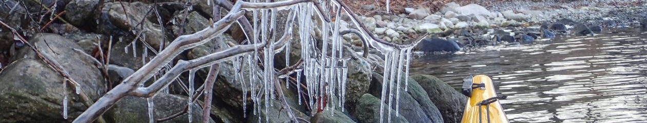
Pic of Iceberg at Great Glacier
9 August: Robert got up early, paddled out on Outwash Lake and then carried the boat back. We packed up and headed downstream. We pulled in at the
salmon factory on river right (the Czech boat was there), talked to some people and bought a 7 lb sockeye for $20 (Cdn!).
Pic of Erwin Lounging on the ketili river (Slough)
After crossing the border and having lunch, we turned down the channel called Ketili River. Be careful not to miss theturnoff if you want to stop at the hot tubs (the river still has a good current and you’ll have to slog upstream). On theKetili, we ran into the students at a side stream located near the top and just east of the west end of map Bradfield Canal C-6. They told us they had seen salmon spawning. We went up the next stream and saw salmon doing their thing, plus lots of wolf and bear tracks; we refilled the water jug.
Pic of Shakes Hotsprings
Back on the Ketili, we paddled up the stream (easy to miss) toward the hot tubs, smelled the sulphur en route, parked the boats and walked to the indoor hot tub where we found the students. We had a glorious playful soak after they left. My companions hadn’t had enough so we went on to the outdoor tub where we found 9 kayakers (in 3 tandems and 3 solos) guided by Alaska Vistas; the guests were mostly from the Netherlands and Belgium. After being motorboated from Wrangell to Shakes Slough, they had paddled the four miles to the tubs in four hours (upstream).
At neither tub did we encounter ill-behaved people as mentioned in some reports. The guides were very helpful re the tides and paddling on the Sound. In particular, we learned that the USFS cabin at Garnet Ledge, which we had reserved, is accessible only at high tide.
On the walk back to the boats we spotted several Steller’s jays. Back on the river, we caught up to the yackers and left ’em in our dust; they were going to
camp some place before the Shakes USFS cabins. We turned up Shakes Slough to USFS cabin #2 (which we had reserved), a nice place in good condition
with few bugs; those sleeping in the loft disturbed the others though when they got up. Supper was the sockeye salmon. Slough water was better than river
water but not up to our standard. In preparation for the next day, we emptied food from one barrel and distributed it among the others (why do we have so
much food near the end of every trip?).
The students were camped in tents by cabin #1 (which is rather small); they were staying 2 nights, then getting picked up and boated back to Telegraph
Creek (I recall the figure of $CDN 1100 for the group but this seems small compared to what I’ve read). Night 19; coordinates were not noted (location
obvious). 110 km (39 km direct).
10 August: We got up early. As we were pulling out, we heard the kids shouting for some reason; of course one’s mind thinks bear. We headed out to get as
far as possible in favourable tide conditions. After going up the more easterly of the two streams on river right just before Kakwan Point and filling the empty
food barrel with not-so-clear water for the rest of the trip, we followed the kayak map and turned right down the small channel immediately after Kakwan
Point, a nice route but not the fastest. We turned down the North Arm and worked our way through the mess of islands just before the river opens up. Even
with almost optimal tide conditions, it was touch and go through the sand flats. As the Alaska Vistas guides had said, the most water was where the water
was most turbulent. At the mouth, we decided (correctly) not to camp at what looked like a grassy site on river left.
We turned north toward Le Conte Bay, wading several times on the now too shallow mud flats on the way. The area near the bay looked like nothing on the topo (Marilyn would disagree!) but it was easily recognized from the ice floes and the cruise ship near shore. The mapping feature on Marilyn’s GPS cleared great confusion from my mind. We pulled in at Camp Island where we had lunch, sheltered from a light rain.