GPS map, locator map, general info etc
Tsunami in the North : Keele River Trip July 2007 (my article in Nastawgan )
– rough version without the pictures – which will be added soon
Following several years of intensive summer canoe trips, I welcomed Bob Bignell’s suggestion of a more leisurely canoe trip, a far north river with great scenery, relatively easy paddling & great hiking. The Keele River has its headwaters in the Mackenzie Mountains near the Yukon – NWT border & flows eastward from there to the Mackenzie River traveling through towering mountain vistas with only the last two days coming down to the lowlands of the MacKenzie Valley. It has no technical rapids per se; however, it flows extremely fast, has some sections with quite high standing waves & does have several major boils.
Five of our group of six had paddled together on previous trips – Bob Bignell, Allan Jacobs, Linda Gordon, Hendrik Herfst & Marilyn Sprissler. Joining us was Jean-Claude Lessnick as our sixth member.
Figure 1: Locator Map
General Logistics
This approximately 375 km. trip can comfortably be done in 2 weeks but since our plan was to allow lots of time for hiking, fishing, exploring & relaxing, we planned on 19 days, including our fly-in (July 3 – July 21). Our original plan was to meet in Norman Wells, take a charter flight with North-Wright Airways to the Keele starting just below the confluence of the Natla & Keele, paddle down the Keele R. to the Mackenzie & then paddle downriver on the Mackenzie to Norman Wells, thus eliminating an expensive flight out & providing us with an opportunity to experience the Mackenzie River. However, upon learning from Rick Meyers, a local outfitter, that on one or two days out of every week, it is almost impossible to paddle downriver on the Mackenzie because of high winds out of the north, we decided to paddle on the Mackenzie only as far as Tulita (previously named Fort Norman) & take a boat ride the rest of the way.
With the new airline regulations only allowing 50 lbs for checked luggage, it is becoming ever more difficult & expensive to fly with your gear so two of us (Hendrik & I) drove my Dodge Ram truck to Yellowknife, taking with us quite a lot of gear. We were able to leave the truck parked at the Yellowknife airport free of charge for the entire 3 weeks because the ticket meters there had broken down a couple of years before & nobody had ever repaired them. To get from Yellowknife to Norman Wells, it is necessary to fly (since there is no summer road access) so we flew with Canadian North who still allowed two 70 lb. pieces of checked luggage. The remainder of the gear we shipped with us via Air Cargo.
We arrived a day before the rest of our group & were picked up in Norman Wells by North-Wright staff & shuttled around by them so that we could pick up last minute items. In addition we were renting one canoe & sprayskirt plus some other gear from Rick Myers. Rick was extremely helpful & also advised us about the normal wind & weather patterns in the area, so last minute we changed our plans to include a pickup by Rick in Tulita. This turned out to be an excellent decision!
Our pre-trip knowledge of possible campsites & highlights was limited since we had been unable to find much concrete information ahead of time. But at the cabin where we spent the night we had the good luck to meet two young fellows, Rob & Taylor who had extremely detailed information about the trip since Taylor’s dad has run many trips down the Keele R. (Al Pace of Canoe North Adventures). So Hendrik & I spent several hours with Taylor poring over maps, getting information on campsites, fishing spots, hotsprings, boils of note etc.
Getting Started: Days 1 – 3
After innumerable delays in Norman Wells, everything was finally loaded into the North-Wright Twin Otter & we took off. It was a fairly short flight, about 30 minutes, during which we flew over some spectacular terrain – first the Mackenzie River, then some low flattish areas, then some of the Mackenzie Mountains which were threaded by braided rivers in the valleys. The mountains were all extremely dry & barren, consisting mostly of sand, gravel & rock. We were thrilled to spot two herds of Dall sheep on the high plateaus. Our landing was noteworthy as we swooped in & bounced like a rubber ball throwing water up in all directions…. first bounce about 20’, next about15’, then a series of gradually smaller, reverberating bumps till we were finally taxiing smoothly on the river. Everything was then ejected from the plane with lightening speed & within 15 minutes the plane was in the air again & we were left standing there.
After a considerable delay while we assembled our two Pakboats, organized everything, loaded all three boats, we were finally able to push off down the river. Our first planned campsite was not far down the river by Delthorpe Creek & Mountain & we already had a good current of about 8 kph to help us, so in less than an hour we were able to pull in & set up our campsite.
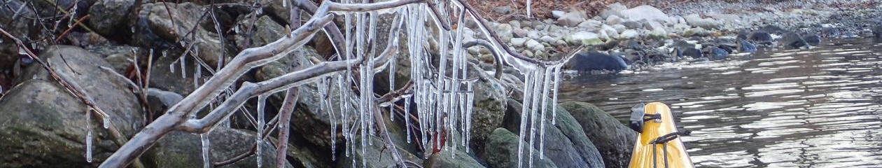
We stayed there for two more days enjoying hiking, fishing, reading, Sudoku & generally having a wonderful time in the mountains. Our whole group did a little hike up Delthorpe Creek, had a lunch & then returned. The following day two of us hunted for a crossing point of the rushing, icy Delthorpe Creek & finally found a spot that was not as dangerous as most of it. We managed the crossing using makeshift staffs & then climbed almost 2000’ on Delthorpe Mountain & were treated to sublime views & a panoply of wildflowers. We maintained contact with our base camp (& the rest of our group) via VHF radios, another of Bob’s great ideas. On the return trip we were treated to a closeup view of a magnificent bull mountain caribou with a huge rack!
Day 4 – 6
As we continued paddling downriver, the current picked up a lot more speed – it was now flowing at about 14-17 kph & we realized that the Keele R. & all the creeks & rivers feeding into it were all in full flood. This made for extreme speed heading down the river!
According to our ‘source’, Taylor, the water was normally very clear & good for drinking, but due to the flooding we found it very silty within a couple of days. In addition, a couple of the giant boils that Taylor had warned us about were non-existent.
Taking advantage of our extra time, we stopped at various creeks & hiked up them – we hiked up the creek coming out of the Shezal Canyon, didn’t make it to the canyon itself as it was quite far upstream but saw numerous wildflowers, especially dryas on the gravelly meadows.
On a couple of other hikes we discovered a lot of orchids. Everywhere along the upper river were stupendous views of huge mountains, some sweeping from high alpine right to the water & many with beautiful colours. At our Day 4 campsite we stayed on a gravel island (which was probably not an island at normal water levels). We had Fortress Mountain for our side view & Mountain Plateau across the river from us with a giant multi-coloured talus slope falling from mid-mountain all the way to the base. To top it off, we discovered, after much searching with binoculars, a few Dall sheep high up in the alpine.
Day 5 saw another late & lazy start – the combination of having lots of time & daylight till 2 a.m. meant our time was totally flexible. After spotting a helicopter going back & forth, we assumed there must be a mining camp nearby & shortly we pulled over – sure enough, there were some geologists, drillers, pilot, cook etc. – total of 15 at the camp. They were looking for copper for a company named Kaska – wholly owned & operated by First Nations.
This camp had an airstrip as well as all the amenities – long distance phone free to anywhere in North America, wireless internet by satellite ($75 per month for both!), satellite TV, etc. etc. etc. They were all very friendly & invited us to their kitchen offering us fruit, drinks, cookies etc.
We did not see the “large waves” that Taylor had mentioned. The mountain scenery continued to be fantastic, dry & rugged. One of the areas looked a lot like hoodoos!
We camped at beautiful turquoise Nidhe Brook – you could see a very distinct line where the clear blue Nidhe joined the silty, muddy flooding Keele!
Days 7-8: Boils, Hotsprings & Tufa Mounds Near the Ekwi
One of the few sections that required some care (large boils & waves, cross currents) was located just above the Ekwi confluence (UTM coordinates 0543000, 7105884). There are 3 possible ways to go down – left is by far the most difficult & requires some scouting; right involves staying close to river right & doing some rock dodging. Near the bottom you can get out & line past a very large whirlpool which is at the bottom. For the third route you can take a stringer which is off to the far right. It is very simple & the only thing to watch for is gravel at the bottom. This avoids both the big whirlpool & finishes just beyond a boil. I am not sure it would be negotiable at normal water levels.
Just where the Ekwi meets the Keele on river left, there is at a beautiful campsite (downriver side of the Ekwi) but it was very difficult to access. We reached it with a lot of difficulty partly because the Ekwi was also in full flood & partly because gravel bars were blocking access to the eddy. Too late we realized that the best way to reach the eddy was to stay mid river (on the Keele) till just below the campsite & then quickly get over to river left & eddy in….definitely a case of ‘too wise too late”!
We had been given detailed & fairly complicated instructions on how to reach the “secret” hotsprings (Godlin R. hotsprings) & tufa mounds by our very knowledgeable source & therefore planned on a layover at this campsite. The hotsprings are actually well known by hunters in the area.
The recommended route involved taking a canoe & working our way up the right hand shore of the Ekwi until we reached cliffs that came to the water, then ferry across with the canoe & continue on that shore until we came to another cliff, then ferry back, then climb up a small embankment using a rope etc. This entire part of Taylor’s instructions was impossible to do because the Ekwi was roaring down in flood & it would have been completely impossible to ferry anywhere at the speed it was going.
We had done a short reconnoitering trip the first evening to see if crossing the cliffs which dropped straight into the Ekwi might be feasible so that is what we proposed to do. So four of us got up at 6 a.m. (Bob, JC, Hendrik & myself) & headed out on a major hike to seek the legendary Godlin R. Hotsprings & tufa mounds. By shortly after 8:20 a.m. we were on our way. It turned out to be an extremely arduous & long hike which included climbing approximately 2700 ‘, traversing a no. of cliffs, some using ropes, a lot of scrambling & a lot of route-searching – we didn’t get back till 8 p.m. that evening. We covered in total about 13.32 km.
In this epic hike, we did a combination of wading in the water & bushwhacking until we reached the cliffs. We then ascended the cliffs to a point where we felt we could cross – there were actually 5 or 6 cliffs altogether which swept down & straight into the ice-cold & extremely fast-flowing Ekwi River. It was extremely difficult going & very treacherous climbing. It took us a couple of hours to cross this section. We then came down for a stretch & then we climbed again & stopped finally for a well-deserved lunch. As we were eating our lunch SIX Dall sheep came down & out into the meadows just across from us. They were really close!! What a thrill…we later saw them again when we were down & they were high, looking down on us. The second time they were farther away.
We struggled with yet more cliffs & ended up using the rope to get myself & Bob up (on the way back we used the rope to descend one very steep cliff).
FINALLY we reached the Godlin R. area, which was our first goal but we needed to cross it also to reach the hotsprings, according to Taylor’s instructions. But it too was in flood & was impossible to cross…so unfortunately, we were out of luck. Later, we found out from Fred Clement in Tulita that it is very often impossible to reach the hotsprings.
We also took along Bob’s VHF radio in order to call in about our progress, but apparently the signal does not travel through mountains!
As in all of our hikes we saw many, many flowers – grass of Parnassus, one-sided wintergreen, one-flowered wintergreen, hawkweed, harebell, green kidney lichen, mistletoe plus numerous others.
This hike was a phenomenal hike & one of our trip highlights, even though we did not reach the hotsprings!
Days 9-12
As we leisurely made our way downriver we stopped in a hunt camp on river right, a very friendly camp catering to very well-heeled clients. Susan, the cook, kindly invited us to stay for lunch since it was still pre-season & they were just making preparations for the guests. From this camp, you can almost touch the Canol Heritage Trail.
The next few days we continued making our way downriver….hiking, fishing, relaxing as we went. Every creek beckoned with excellent hiking – much like the Nahanni. We spotted grizzly, caribou & wolf tracks, dippers playing in the creeks, numerous soaring ospreys, a glaucous gull & scaup. The river became gradually braided as the valley broadened. At one point we could see haze from a forest fire, but we never got close to it.
Day 13
We continued paddling downriver, not expecting any scary moments (since our ‘source’ had not mentioned anything in this area) but there were 2 spots that were very bad – we had a narrow escape on the first spot & came within a hair’s breadth of dumping on the second. Both were giant boils. The first one occurs at approx. UTM 548, 281 where the river makes a sharp turn to the right. There is a cliff on river left & shallow gravel on river right. Our mistake was to try to avoid the shallow gravel & we thus, thinking it was just standing waves, headed right towards where the boils were in mid-channel. All 3 canoes had to paddle extremely frantically in order to get away from the seemingly ever-expanding & very scary-looking boils.
The second set of boils was again totally unexpected (location approximately UTM597, 247). You would think we had learned our lesson, but no…exactly the same scenario happened, just in the other direction – river made a sharp left, cliffs were on river right & gravel on river left. This time Hendrik & I got caught in them, did a couple of 360’s & flipped completely on our side at one point showing off the bottom of our boat. Hendrik did a massive brace on the right (stern) & I did in massive brace on the left (bow) & magically the boat did not flip but returned to its normal upright position. Bob, who had an excellent view of the bottom of our boat was sure that we’d had it. Such confidence!
I don’t think I’ve mentioned the extreme speed of this river. A dump would have been very bad mainly because of the river speed. There are almost no technical rapids in this river, but because it was in flood, there were a lot of waves (2-3′ in height perhaps) & boils in many places. Most of the boils were quite manageable though. Apparently the normal speed of the river averages about 8 kph (according to Taylor), but our experience in the flooded river was that it was flowing at anywhere from 12 to 20 kph. With paddling, our speed was quite often over 20 kph and reached about 25 kph a couple of times!!
Days 14-15
We passed Red Dog Mountain, the last of the mountains & gradually the terrain became quite broad & flat & the river was very braided. There was quite an extensive bluff section that we paddled past under heavy rains. At one point just as we approached very high cliffs on river left, a pile of dirt & gravel crashed into the river. It lasted at least about 30 secs. & was quite amazing.
When we finally arrived at the mouth of the Keele, the Mackenzie was quite a sight. It was glassy smooth, very fast current & it extended as far as we could see in both directions & almost a km. in width. We crossed to the other side, explored an unoccupied native hunt camp & then very shortly after stopped for the day. Campsites on the Mackenzie are few & far between.
Day 16: Tsunami!!
After a rather late start, we paddled for a couple of hours on river right about 100 feet offshore, admiring the high bluffs. We then gradually crossed over to river left, had lunch & continued on.
We were on river left, maybe 50′ – 100′ offshore, when all of a sudden we saw a wondrous sight. Way across the river on river right one of the high large bluffs collapsed!!!!! This was the most amazing thing I have ever seen in my life – the bluff was probably about 300-400’ feet wide, 150’ deep & about 100’high. The whole thing slumped downwards & pushed into the water!!! After the initial giant chunk, there were many smaller chunks that continuously released. We were all sitting watching – in awe of this spectacle, when suddenly (after about 3-5 mins), Allan yelled “WAVE”!!!! “GET TO SHORE”!!! In horror we all saw this racing, frothing, foaming wave just in front of Allan.
We all paddled towards the shore as if our lives depended on it. Allan & Linda just made shore when the wave struck them. Linda had hopped out & was on the water side of the boat & Allan was on the land side. All we saw was them & their canoe go flying (out of the corner of our eyes….as we frantically paddled). Last thing we saw were Linda’s feet up in the air.
We (Hendrik & I) reached shore, threw ourselves out & tried to haul up the canoe out of the way, but it was extremely sucky muck & willowy (low shrubs). We didn’t get far before we were stuck in the muck since our canoe was fully loaded. I yelled “RUN!”, grabbed my camcorder which was sitting loose in the boat & we both ran as fast as we could. We made it far enough up on to the shore that when the wave hit us it just washed around our knees.
The wave picked up our loaded canoe & hurled it up & way over – a total of maybe 50′ from where we had deserted it. Bob & JC had a bit more time & were at a slightly different angle when the wave hit, so although the wave threw their boat up on shore also, it didn’t go quite as far.
Once the wave had passed, we collected ourselves, found that Linda & Allan were OK even though both they & their canoe had been tossed over. Allan’s canoe did get punctured by a branch when it was thrown, but it was not a serious hole & he fixed it later.
Everyone was pretty shaken up by the experience & as we talked about it, by the thoughts of what would have happened had we still been in the middle of the river or, much worse, on river right admiring the cliffs. Had we been anywhere out from shore the wave would have dumped all 3 canoes & with the current & debris in the water it would have taken us the rest of the day to rescue ourselves. Had we been under the cliff or within a couple hundred feet of it, it definitely would have been ‘game over’.
As we stood on the shore discussing the wave, we saw 2 other waves racing upriver at a different angle. They were a bit smaller, but just as fast. A third wave went in a slightly different direction – up & to our right.
So – we pumped the water out of our canoes & hauled them back to the river, one at a time. It took all of us to manage each boat, since they were completely loaded.
Post – Tsunami
The second last day of the trip was quite leisurely as we didn’t have much distance to cover. Due to the amount of rain over the last couple of weeks & especially the last few days, there was an enormous amount of debris in the river & the Mackenzie was extremely silty. We spent a fair amount of time searching for a fresh stream so that we could fill a small barrel with water. Of special note was a small section on river right. We noticed what looked like coal seams in the low bluffs & then saw a couple of spots that looked like campfires burning. We stopped to look more closely, & sure enough, to our astonishment, we found a few spots that were spontaneously combusting – exactly like the Smoking Hills phenomenon on the Horton R.
Also of interest was the almost complete lack of boat traffic on the Mackenzie. We had all expected it to be a boat highway & were pleasantly surprised at the relative solitude, seeing only a couple of barges, 2 small boats & the Coast Guard. On our last night out we stayed on Police Island – our advice from Taylor was dead on – it was the ONLY possible spot to camp in this entire stretch of the river. Everywhere else was swampy or bluffs.
Our final paddling day saw us again crossing the river left to right (about 2 km. wide at this point). There was a wind out of the north which built steadily. Once on the river right we needed to pass a very long section of bluffs. Slightly unnerved from our earlier experience we looked at them carefully & noticed that these were composed of mostly rock, not soft dirt like the large mass we had seen collapse. We fought hard to paddle downriver the rest of the way to Tulita, since the wind & swells were now very large and eventually our efforts paid off & we arrived at the town dock & surfed in to shore on the backs of the waves. Rather a dramatic end to our trip!
Several people came down to the beach in their trucks to chat with us, among them Fred Clement. He gave us the news that because of the high wind & waves, Rick Myers would be unable to make his way upstream to Tulita with his boat to pick us up. Instead, Fred would take us to Norman Wells with his far more powerful jet boat. He kindly invited us to camp in his pleasant, grassy backyard, instead of on the very undesirable gravel beach so after some frenzied packing – we had to take the 2 Pakboats apart & it was pouring rain – & several trips with his truck, we were up at Fred’s place. We spent the evening chatting & story-telling inside Fred’s large tipi which he uses for smoking & drying meat & fish and for barbeques.
Tulita is a very friendly little town of abut 450-500 people, most of whom are native. It is situated where the Great Bear River comes in to meet the Mackenzie. Great Bear R. is clear & a beautiful deep jade colour. Just across the mouth of the river is a striking mountain & in almost any photo you see of Tulita, it is shown with this mountain in the background. There are three large oval marks on the mountain & local legend explains that these marks are actually giant beaver pelts laid out on the mountain.
While in the tipi Fred told us a legend about Yamouri – supposedly there were three giant beavers who were eating the people so Yamouri killed them & laid the beaver pelts on the mountain. And the ‘smoking hills’ area we passed yesterday is supposed to be the remnants of his bonfire.
Return to “The Wells”
Today consisted mainly of packing Fred’s jet boat – a job that took a lot of time & careful placement of gear. Apparently in a jet boat, most of the weight should be forward – so first we packed every nook & cranny of the front of the boat with whatever would fit there, then barrels in the rear holds, packs in the middle, canoe along the middle & then finally we squeezed ourselves in.
We then drove the boat fully loaded down to the beach, all climbed into the boat & another fellow backed the boat quickly into the water, Fred gunned the engines into reverse, we swung around & then we were off. This took mere seconds. The wind & waves were high & there had been a lot of discussion earlier about when the wind might lessen.
This was the wildest, roughest motorboat ride (actually jet boat ride) that I have ever been on – bar none!! And apparently a jet boat gives you the smoothest ride possible.. Fred is truly an expert boat driver! We rode along the shore, only about 20′ off the shore, crashing and diving into & around the waves. I’ve never seen anything like it. We were constantly thrown into the air & from side to side, but eventually we made it. It took almost exactly 2 hours.
We were met by Rick, who took us via several trips to the Mackenzie Hotel and spent most of the rest of the day sorting & packing to organize for the flight from Norman Wells to back to Yellowknife.
Summary
This was one of the all-round best trips I’ve ever been on! It had all the components that make a memorable trip: spectacular scenery, good company, great hiking, great campsites, huge variety of terrain, excitement, serenity & solitude.
Rick Myers of Norman Wells was a great help with some of our outfitting & transportion & was very pleasant to deal with. Fred Clement, who stepped in to help at Tulita was extremely generous, friendly & helpful. And Taylor was extremely helpful and generous with his advice about the river.
Figure 10: Chart of Campsite Locations, Distances, Elevations, Weather
| DAY | CAMPSITE | UTM | DISTANCE | ELEVATION | WEATHER |
| July 3 | Start Point
Plane landing |
0546167 7051521 | 0 | 2807′ | |
| July 3 | 1
Delthorpe Cr. |
0546638
7055126 |
4.4 Km | 2790′ | Mixed drizzle, rain, lots of rain, overnight some clouds & no rain |
| July 4 | “ | “ | 0 | “ | Cleared, variable clouds, sunny periods, some wind |
| July 5 | “ | “ | 0 | “ | Cloudy in the a.m., variable-> sunny in the p.m., short shower then heavier shower, then clear again |
| July 6 | 2 | 0555275
7073780 |
26.2 km. | 2569′ | Cleared in the a.m. & was good. |
| July 7 | 3
Nidhe Brook |
0548995
7098677 |
30.57 km. | 2284′ | Great weather – no rain so far! |
| July 8 | “ | “ | 0 | “ | Clear beautiful a.m., turned variable later & rainy in the early evening. |
| July 9 | 4
Ekwi R. |
0542013
7106991 |
~12 km?
check |
~2178′ | Beautiful day all day long! |
| July 10 | “ | “ | 0 | Quite cold & cloudy this a.m., clear to variable & fresh temps., 15-20 min shower mid p.m., cool & quite breezy at night. Typical mtn. weather! | |
| July 11 | 5 | 0571789
7121802 |
50.29 km. | 1769′ | Mixed again, sunny evening. |
| July 12 | 6 | 0589767
7121187 |
22.69 km. | 1582′ | Beautiful hot sunny day (so far) |
| July 13 | “ | “ | 0 | “ | Absolutely beautiful, sunny, hot day. In the evening a small sprinkle & haze – possibly from some forest fire. |
| July 14 | 7
Big gravel outwash |
0623337
7124679 |
42.64 km. | 1169′ | Not so great – cloudy, humid, heavy rain around 5:30-8:00 p.m. |
| July 15 | 8 | 0361465
7124282 |
39.85 | 444′ | Beautiful – hot sunny. Then thundershowers in early evening. |
| July 16 | 9 | 0400342
7125841 |
52.74 km. | 402′ | Hot, sunny, humid |
| July 17 | 10 | 0414685
7145909 |
42 km. | ~250′ | Poured rain all day. Cleared around 6 p.m. |
| July 18 | 11
Island in the Mackenzie |
0404049
7175962 |
40.78 | 225′ | Hot, sunny, muggy all day |
| Tsunami UTM | 0409917
7173786 |
(where we were hit) | 200′ | ||
| July 19 | 12
Police Island |
0398829
7193573 |
20.49 km. | 208′ | Sunny, hazy. Some showers in the evening. |
| July 20 | 13
Tulita |
782
995 |
22.70 km. | 197′ | Very windy, cloudy, rain (lots) from about 6 p.m. onwards. |